


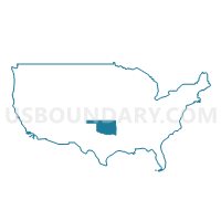
Garfield, Kay & Noble Counties--Enid City PUMA, Oklahoma
About
Outline

Summary
| Unique Area Identifier | 193803 |
| Name | Garfield, Kay & Noble Counties--Enid City PUMA |
| State | Oklahoma |
| Area (square miles) | 2,747.57 |
| Land Area (square miles) | 2,710.09 |
| Water Area (square miles) | 37.48 |
| % of Land Area | 98.64 |
| % of Water Area | 1.36 |
| Latitude of the Internal Point | 36.53309590 |
| Longtitude of the Internal Point | -97.41455170 |
Maps

Graphs
Select a template below for downloading or customizing gragh for Garfield, Kay & Noble Counties--Enid City PUMA, Oklahoma


Neighbors
Neighoring Public Use Microdata Area (by Name) Neighboring Public Use Microdata Area on the Map
- Flint Hills Region--Emporia City PUMA, KS
- Panhandle & Northwest Oklahoma PUMA, OK
- Payne, Seminole, Creek (Southwest), Hughes & Okfuskee Counties--Stillwater City PUMA, OK
- Pottawatomie (North), Logan & Lincoln Counties--Shawnee City PUMA, OK
- South Central Kansas PUMA, KS
- Washington, Osage (North & West), Pawnee & Creek (Northwest) Counties PUMA, OK
Top 10 Neighboring County (by Population) Neighboring County on the Map
- Payne County, OK (77,350)
- Garfield County, OK (60,580)
- Osage County, OK (47,472)
- Kay County, OK (46,562)
- Logan County, OK (41,848)
- Cowley County, KS (36,311)
- Sumner County, KS (24,132)
- Pawnee County, OK (16,577)
- Kingfisher County, OK (15,034)
- Noble County, OK (11,561)
Top 10 Neighboring County Subdivision (by Population) Neighboring County Subdivision on the Map
- Stillwater CCD, Payne County, OK (63,113)
- Enid CCD, Garfield County, OK (53,331)
- Ponca City CCD, Kay County, OK (28,955)
- Blackwell CCD, Kay County, OK (8,080)
- Perry CCD, Noble County, OK (7,753)
- Pawnee CCD, Pawnee County, OK (5,198)
- Hennessey CCD, Kingfisher County, OK (4,333)
- Tonkawa CCD, Kay County, OK (3,978)
- South Garfield CCD, Garfield County, OK (3,851)
- Newkirk CCD, Kay County, OK (3,705)
Top 10 Neighboring Place (by Population) Neighboring Place on the Map
- Enid city, OK (49,379)
- Ponca City city, OK (25,387)
- Blackwell city, OK (7,092)
- Perry city, OK (5,126)
- Tonkawa city, OK (3,216)
- Newkirk city, OK (2,317)
- Waukomis town, OK (1,286)
- North Enid town, OK (860)
- Garber city, OK (822)
- Morrison town, OK (733)
Top 10 Neighboring Elementary School District (by Population) Neighboring Elementary School District on the Map
Top 10 Neighboring Unified School District (by Population) Neighboring Unified School District on the Map
- Stillwater Public Schools, OK (51,774)
- Enid Public Schools, OK (44,870)
- Ponca City Public Schools, OK (29,349)
- Arkansas City Unified School District 470, KS (16,699)
- Blackwell Public Schools, OK (7,827)
- Perry Public Schools, OK (7,153)
- Chisholm Public Schools, OK (4,488)
- Pawnee Public Schools, OK (4,241)
- Tonkawa Public Schools, OK (3,929)
- Hennessey Public Schools, OK (3,859)
Top 10 Neighboring State Legislative District Lower Chamber (by Population) Neighboring State Legislative District Lower Chamber on the Map
- State House District 41, OK (46,325)
- State House District 31, OK (44,222)
- State House District 33, OK (37,766)
- State House District 36, OK (37,155)
- State House District 35, OK (36,242)
- State House District 40, OK (35,717)
- State House District 59, OK (35,665)
- State House District 58, OK (33,694)
- State House District 37, OK (32,866)
- State House District 38, OK (32,291)
Top 10 Neighboring State Legislative District Upper Chamber (by Population) Neighboring State Legislative District Upper Chamber on the Map
- State Senate District 21, OK (81,344)
- State Senate District 19, OK (77,948)
- State Senate District 10, OK (76,617)
- State Senate District 27, OK (72,228)
- State Senate District 20, OK (68,510)
- State Senate District 32, KS (66,171)
Top 10 Neighboring 111th Congressional District (by Population) Neighboring 111th Congressional District on the Map
Top 10 Neighboring Census Tract (by Population) Neighboring Census Tract on the Map
- Census Tract 13, Garfield County, OK (7,838)
- Census Tract 7, Garfield County, OK (6,506)
- Census Tract 15, Garfield County, OK (6,498)
- Census Tract 6, Garfield County, OK (6,480)
- Census Tract 1, Kay County, OK (5,837)
- Census Tract 1, Garfield County, OK (5,810)
- Census Tract 110, Payne County, OK (5,735)
- Census Tract 16.01, Garfield County, OK (5,625)
- Census Tract 111.01, Payne County, OK (5,177)
- Census Tract 2.02, Kay County, OK (5,106)
Top 10 Neighboring 5-Digit ZIP Code Tabulation Area (by Population) Neighboring 5-Digit ZIP Code Tabulation Area on the Map
- 74074, OK (29,184)
- 73703, OK (27,951)
- 73701, OK (24,808)
- 74075, OK (23,866)
- 74601, OK (20,257)
- 67005, KS (16,535)
- 74604, OK (12,301)
- 74631, OK (7,709)
- 73077, OK (7,135)
- 74058, OK (4,259)